Using Satellites to Monitor Wildfires

The daunting effects of global warming include drought and the overexploitation of land for commercial purposes, which has brought about significantly larger wildfire sizes, frequencies, and environmental consequences. To prevent these fires from endangering people and animals, it is critical to observe the first moments following the ignition of a fire to discover its exact location, speed, and direction of expansion. However, firefighters on the ground are not always capable of calculating these factors accurately. Similarly, without quality statistical data on forest fire sizes and affected areas, scientists cannot accurately estimate the extent of a fire’s destruction. That’s where satellites come in, using innovative remote sensing technologies to provide a cost-effective, timely solution to these issues, saving lives and land in the process.
This article will delve into exactly how satellites can be used to monitor wildfires from space, mitigating destruction on Earth in the process.
How Do Wildfires Start?
2021 has seen hundreds of thousands of acres burn in the US. Indeed, due to the pressing dangers of climate change, over 80 large wildfires have burned over 1.3 million acres across 13 states this year alone according to the National Interagency Fire Center, with additional fires igniting almost weekly. So, how exactly do these fires start?
From 7th-9th March, the National Oceanic and Atmospheric Administration (NOAA) satellites monitored various wildfires across the Southern Plains, revealing that these fires were partially ignited naturally due to overly hot, dry conditions. However, some of these fires were also ignited due to prescribed burns, which are used to manage landscapes and ecosystems across the US. The US Forest Service reports several benefits of prescribed burns, such as protecting human communities from extreme fires, improving habitats for threatened and endangered species, and promoting the growth of trees, wildflowers, and other plant life. Nonetheless, regardless of fire type, all tracking wildfires is central to preventing a loss of control.

Why is Wildfire Monitoring Important?
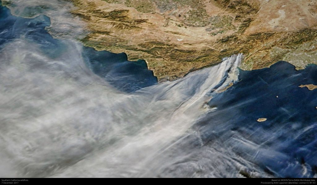
Beyond a loss of control, there are several reasons why it is important to track wildfires from space. For instance, understanding how smoke travels through the atmosphere is crucial to air quality, visibility, and human health.
Satellites such as Terra can inform firefighters on the movement and thickness of smoke at the peak of a wildfire. This wildfire satellite carries the Multi-angle Imaging SpectroRadiometer (MISR), a device which uses nine fixed cameras to observe Earth at different angles. MISR can measure the motion and height of a fire’s smoke plume, as well as the volume of smoke particles emanating from the fire, to indicate the plume’s composition. It can also monitor whether the smoke’s plume height exceeds the ‘near surface boundary layer’ where pollution most commonly concentrates. In short, measuring smoke through wildfire detection satellites can help firefighting efforts from the air.
In addition to measuring smoke behaviour, remote sensing from wildfire satellites can help forest managers to identify burned areas, classify burn severities, and estimate the total burned area. These measurements can be obtained for a myriad of fires to determine the fire’s location, duration, size, temperature, and power output, data which would otherwise be unavailable.
Historically, incident meteorologists were resigned to using low-resolution images that updated every 15 minutes and were typically 20 years old by the time they reached the forecaster. Today, wildfire detection satellites can identify fires before they are even observed on the ground, which is often 10-15 minutes before emergency calls come in.
Now that we have a better understanding of why wildfire monitoring is so important, let’s dive into a brief history of remote sensing.
History of Using Remote Sensing to Detect Wildfires
January 1980 marked the first instance in which scientists Matson and Dozier detected a small wildfire from on the Persian Gulf. This image was captured by the Advanced Very-High-Resolution Radiometer (AVHRR) instrument on the NOAA-6 satellite and depicted campfire-sized flares resulting from the burning of methane in oil wells.
Dozier eventually developed a mathematical method to help distinguish small fires from other heat sources, and the technology developed through AVHRR informed the design of the first instrument with spectral bands designed to track wildfires.

In 1999, NASA’s Moderate Resolution Imaging Spectroradiometer (MODIS) was launched on the Terra satellite to create a satellite fire map of files and burn scars with a greater accuracy than that of the AVHRR. From there, space technological developments grew exponentially until 2014 when the Rapid Analytics for Disaster Response (RADR) was developed.
RADR uses image-capturing technology from wildfire satellites, aircrafts, drones, artificial intelligence, and cloud computing to assess the impact of natural disasters. This instrument can detect the track wildfires and their boundaries multiple times a day, associating the fire’s impact and risk with structures, substations, and any other critical infrastructures found in the surrounding landscape. RADR is particularly useful when incident commanders are unable to accurately track a wildfire’s size and location as these remote sensing images can then be analysed by support staff to create satellite fireline maps.

Click here more information about remote sensing.
How It Works
In conjunction with planes operated by the US Forest Service, large global constellations of satellites provide an overarching view of wildfires from space that can inform firefighters’ decisions on the ground, such as where to stage national assets when there is a high competition for firefighters, tankers, and aircrafts.
As previously mentioned, it is quite common for satellites to detect and monitor wildfires before they are discovered on Earth, especially in remote regions such as the Alaskan wilderness. This is achieved through visible and infrared sensors on high-resolution Earth observation wildfire satellites. Near-infrared (NIR), mid-infrared, and thermal bands can detect changes in vegetation health as a fire progresses, making them essential to supporting forest management practices during the peak of a fire.
To measure burn severity, scientists use the Normalized Burn Ratio (NBR), which identifies areas significantly altered in their spectral signature by wildfires. The NBR is calculated using energy from NIR and short-wave infrared (SWIR) wavelength bands produced from the remotely sensed satellite imagery.
Calculating the NBR requires two wildfire satellite images of the same area to be captured: a master image and a slave image. The master image is captured in the closest time to the fire’s ignition, and the slave image is captured most recently after the master image. Computing the NBR for both master and slave images enables firefighters to identify the total burned area, as well as the areas most heavily impacted.
Satellite Types
Two primary satellite types exist to track wildfires:
-
Polar orbiters, which provide detailed views of the fire and smoke globally up to twice a day (e.g. Terra, Aqua, NASA-NOAA Suomi NPP)
-
Geostationary satellites, which orbit Earth in an equatorial plane within a 24 hour period, the same rate at which the Earth orbits, and therefore remain at a fixed longitude above the equator. This enables a 5-minute repeat imaging of a portion of the globe. However, these images have a coarser spatial resolution than polar orbits.

Here’s a few examples of these wildfire satellites that are orbiting our Earth as you read…
AIRS Instrument
The Atmospheric Infrared Sounder on NASA’s Aqua spacecraft was designed to monitor the concentration and global patterns of carbon monoxide pollution from wildfires in the mid-troposphere between 1.2-6.2 miles (2-10 kilometeres). As previously discussed, combining several thermal bands of AIRS imagery allows the creation of a false-colour composite image depicting both the concentrations and temperatures of carbon monoxide circulating in the atmosphere. Areas of high carbon monoxide concentration show up in yellow and red.
AIRS is specifically designed to detect carbon monoxide in the mid-troposphere between 1.2-6.2 miles (2-10 kilometres), with a peak sensitivity at approximately 5 kilometres.

Did you know? Even astronauts at the ISS capture camera and video imagery of wildfires and smoke plumes as they orbit Earth. This imagery is compiled into a universal library that scientists and fire managers depend upon to make discoveries and support wildfire management decision processes.
ASTER
ASTER, or the Advanced Spaceborne Thermal Emission and Reflection Radiometer, is attached to NASA’s Terra satellite to track wildfires through the mapping and monitoring of the planets volatile surfaces. ASTER’s ability to provide broad spectral coverage helps scientists and firefighters on the ground to create satellite fire maps, which are central to understanding and tracking the ever-changing conditions of a wildfire.

Learn More
Still curious about satellites and their ability to track natural disasters?
If you would like to learn more about wildfire detection satellites and their ability to monitor the various patterns of climate change, visit the National Oceanic and Atmospheric Administration’s (NOAA) website.
For more information about the fascinating methods and technologies used to track wildfires in some of the arid climates found in the United States, visit the US Forest Service website.
References
1. Aditya Sharma. (2020). Monitoring Wildfires Using Earth Observation Satellites. Last accessed 22 Feb 2022.
2. Alicia Victoria Lozano. (2021). Using satellites and AI, space-based technology is shaping the future of firefighting. Last accessed 22 Feb 2022.
3. Jenny Marder. (2019). NASA Tracks Wildfires From Above to Aid Firefighters Below. Last accessed 22 Feb 2022.
4. National Environmental Satellite Data and Information Service. (2021). Earth from Orbit: Tracking Fires from Space. Last accessed 22 Feb 2022.
5. Rob Gutro. (2021). NASA Covers Wildfires Using Many Sources. Last accessed 22 Feb 2022.


